Category Archives: Ireland
5*S Extreme Weather Story Map Collection
Measuring Drainage Basins of 10 Major World Rivers
Lurgan College
Hero banner

Lurgan College
Understanding different points of view
In the town of Lurgan in Northern Ireland, ArcGIS is not just transforming the way that geography is taught in the classroom; it is also bringing together students from different religious communities. Lurgan College has used ArcGIS mobile solutions to help build bridges between young people from different parts of the town and give students an unprecedented level of understanding of other points of view.
Esri’s Survey123 app allows students to record their feelings in different parts of the town on their smartphones
ArcGIS displays students’ views on an interactive map, promoting understanding and initiating conversations
Esri Ireland and GeoMentors provide ongoing support for Lurgan College, helping it introduce new GIS projects
Why GIS?
“Why would you not want to use GIS in schools?” asks geography teacher Alistair Hamill. “GIS is geography in the real world, so young people need to know that it exists.” Hamill has been the driving force behind the introduction of GIS into geography lessons at Lurgan College, a selective, non-denominational, co-educational Grammar School in Northern Ireland for young people between the ages of 14 and 19.
Located in County Armagh, around 18 miles south west of Belfast, the town of Lurgan has historically experienced a high level of tension between Catholic and Protestant populations and was the scene of many acts of sectarian violence in the past. After attending a workshop held by Esri Ireland, Hamill was inspired to use GIS not only as a tool for teaching geography in his classroom, but also as a way to bring young people from different communities in the town closer together.
The use of GIS was transformative in how it enabled students to understand the points of view of other students from different schools, with different backgrounds.
Benefits for students
With support from Esri Ireland and free access to Esri’s ArcGIS technology, through the ArcGIS for Schools programme, Hamill successfully launched an initiative that has had a profound impact on students’ perceptions of other people from different religious backgrounds.
Using Esri’s Survey123 solution, he built an app which students could use on their own mobile phones to record how they felt at different locations around the town. Then, through the town’s ‘Shared Education’ programme, he brought together students from different schools and took them to Catholic and Protestant areas that they wouldn’t normally go to, guided by a local police officer.
All the data collected about students’ perceptions of different locations was captured anonymously on interactive maps, using ArcGIS, enabling the students to explore others’ feelings. “The use of GIS was transformative in how it enabled students to understand the points of view of other students from different schools, with different backgrounds,” Hamill says. “We found that students were very honest in recording their feelings at locations where they didn’t feel comfortable and this led to very powerful conversations.”
The project broke down barriers between students from different areas in an unprecedented way, paving the way for greater community cohesion in the future. “Using ArcGIS, students could see that not everyone from the same school felt the same way, which challenged established stereotypes and promoted better understanding of other communities,” Hamill says.
While this particular project is ground-breaking and awe-inspiring, Lurgan College is also using ArcGIS in more conventional ways, in classrooms, to support the teaching of GCSE and A level geography. For example, in one project, students have used ArcGIS to study downstream changes in the Glendum river valley. “The ability to view the topology of an area in 3D, using ArcGIS, helps students to better understand the landscape,” Hamill says.
The use of GIS has also expanded out of the geography department and into other faculties at Lurgan College. For example, the Survery123 perceptions app was used by a group of history students during a recent trip to Belfast. Through projects like this, Lurgan College is making it possible for a larger number of students to gain experience of using GIS technology and build digital skills for life.
Esri Ireland and GeoMentors are only ever a phone call or email away. Whenever we need some know-how, there is a team of people we can contact for help.
The teacher’s perspective
Since signing up to Esri Ireland’s ArcGIS for Schools programme, Hamill has been able to transform the teaching of geography at Lurgan College and provide eye-opening new opportunities for students throughout the town – and he hopes that his experiences will inspire others. To teachers who may be considering using ArcGIS for the first time, he says, “Give it a go. ArcGIS will help you teach geography better and could provide a gateway to amazing things.”
He is keen to point out that the way Lurgan College has used ArcGIS and Survey123 to survey opinions could be replicated by other schools to explore different scenarios, including socio-economic or ethnic divides. “GIS provides a very effective way to explore a wide range of complex issues,” he says.
Hamill recognises that teaching with GIS may be daunting at first, especially for teachers, like himself, who did not have the opportunity to learn GIS at university or in their prior careers. He benefited from the support of a PGCE student who had experience of using GIS and was fortuitously training at his college. In addition, he attended free training events organised by Esri Ireland and tapped into the expertise of Esri Ireland’s extended team of GIS ambassadors, called GeoMentors. “Esri Ireland and GeoMentors are only ever a phone call or email away,” Hamill says. “Whenever we need some know-how, there is a team of people we can contact for help.”
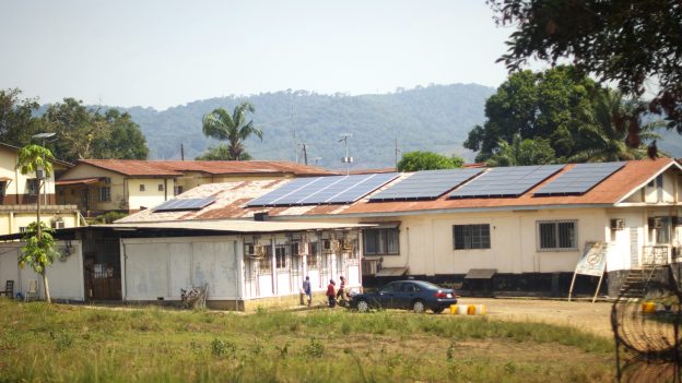
Christian Brothers College Cork
St Mary’s CBS The Green
Hero banner
St Mary’s CBS The Green
Helping pupils to understand their world
Pupils at St Mary’s CBS The Green School in Ireland and other secondary schools nearby have been finding out more about the world they live in using ArcGIS. Through the expertise and encouragement of an inspirational teacher, they are learning skills that will help them progress in their future careers.
ArcGIS for Schools provides all the software, resources and support teachers need, for free
Pupils learn to use industry-standard GIS software and build their team-working and project management skills
Pupils can use GIS tools in field work, in the classroom and at home, via the Internet, to explore diverse topics
Why GIS?
Teacher Jennifer Stack had worked in the geographic information system (GIS) industry for many years before moving into education. She was therefore well aware of the capabilities of GIS and the many different ways that this technology can be applied in our world today to help people solve complex societal, environmental and economic challenges.
However, Ms Stack found that most young people didn’t encounter GIS while at school and were therefore oblivious of the opportunities that it might offer them in their future. “A lot of young people are unaware of GIS as a potential career,” she says. “I wanted to change this by offering GIS lessons in my own school, but also by working with other schools in Ireland to share my knowledge and enthusiasm for GIS.”
The Esri ArcGIS for Schools programme is unbelievable. It provides full access to the Esri ArcGIS software, for free, and includes resources and support from Esri Ireland all the way.
Benefits for students
Ms Stack began by teaching GIS to a group of 60 pupils at St Mary’s CBS The Green School, the Catholic all-boys secondary school where she works. Pupils used Survey123 for ArcGIS to collect data at Dingle Ocean World, using mobile devices, and complete surveys about ecosystems along the shoreline. They then used ArcGIS to display their data on interactive maps and created highly visual story maps. This project enabled the pupils to gain practical experience of using GIS to collect data in the field, analyse it and present their findings clearly in a digital format.
After achieving success in her own school, Ms Stack established a Creative Cluster of four national schools and began to share her expertise with other teachers throughout the area. With her support, students at the nearby Presentation Secondary School, an all-girls school, explored gender equality in education using ArcGIS. In other schools, students used ArcGIS to investigate topics as diverse as the local marine industry, food waste and the health of the bee population. “Pupils come up with wonderful ideas for projects!” Ms Stack says. “GIS is a powerful tool for them to analyse the world they live in. I just give them the right tool to explore their ideas and they run with it.”
Ms Stack believes that giving young people the opportunity to use GIS helps to get them involved in real world issues. “GIS gives young people a voice,” she says. “They can investigate the community they live in, analyse data for themselves and evaluate the significance of issues at a global level. Pupils can use GIS to gain answers to their questions and see more clearly what they can do in their communities to improve the environment or help other people, for example. It helps them to take ownership of important issues.”
The teaching of GIS in schools also enables pupils to learn valuable new skills that will benefit them in their future careers and studies. As well as learning technology skills, the pupils learn how to work in teams to explore topics from different perspectives and present their points clearly. For example, one group of students created an ArcGIS story map to support a Safer Internet campaign and raise awareness of online safety with students, teachers and parents in the community.
In another particularly successful project, Ms Stack brought together science students and geography students to explore attitudes to the HPV vaccine. The students used ArcGIS to survey local opinions and present a series of recommendations, backed by evidence. Their hard work and accomplished use of GIS technology earned them third place in the Social and Behavioral Sciences intermediate group category at the BT Young Scientist Award competition.
GIS gives young people a voice. They can investigate the community they live in, analyse data for themselves and evaluate the significance of issues at a global level.
The teacher’s perspective
“The Esri ArcGIS for Schools programme is unbelievable,” Ms Stack exclaims. “It provides full access to the Esri ArcGIS software, for free, and includes resources and support from Esri Ireland all the way, as well as the platform for hosting data. Through the programme, students can also log into ArcGIS Online from home, to continue their GIS projects as homework. Pupils get the opportunity to use industry-standard software and gain transferable skills that they can use in their future careers.”“The Esri ArcGIS for Schools programme is unbelievable,” Ms Stack exclaims. “It provides full access to the Esri ArcGIS software, for free, and includes resources and support from Esri Ireland all the way, as well as the platform for hosting data. Through the programme, students can also log into ArcGIS Online from home, to continue their GIS projects as homework. Pupils get the opportunity to use industry-standard software and gain transferable skills that they can use in their future careers.”
The comprehensive and supportive nature of the ArcGIS for Schools programme made it very easy for Ms Stack to convince her head teacher, Anne O’Callaghan, of the feasibility of introducing GIS into the curriculum. “When I went in to talk to my principal and propose GIS lessons, I gave her details of the ArcGIS for Schools programme, and there was very little persuading to do,” she recalls.
Ms O’Callaghan is passionate about providing digital learning opportunities for students and has given Stack her full support. St Mary’s CBS The Green School became the first school in Ireland to timetable GIS lessons for six classes a week, and it hosted a GIS Day to inspire teachers and pupils from other schools. Thanks to the flexibility of the ArcGIS for Schools programme, Ms Stack has been able to deliver valuable lessons for groups of students throughout the area, even in classrooms where there are no PCs on desks. “I take along my own laptop,” she explains. “Because ArcGIS works on the cloud, it is possible to teach GIS outside of computer labs. I always tell schools: Don’t worry about what technology you have available to you. There is always a way to integrate GIS into your teaching.”

Confey College Leixlip

Presentation Secondary School Wexford
St. Conleth’s College
