Category Archives: Ireland
Methodist College
Methodist College
Methodist College
Presentation College Headford
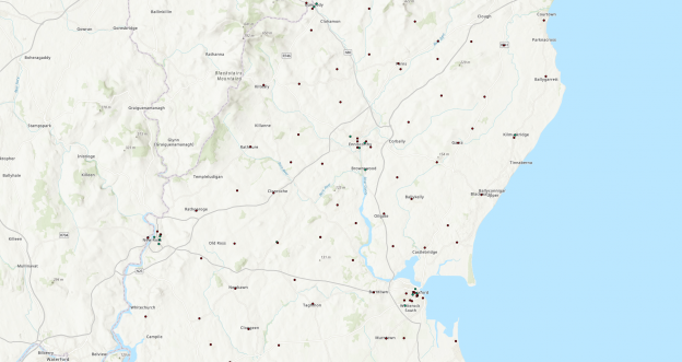
Hero banner
Presentation College Headford
Inspiring students through digital storytelling
At Presentation College Headford in County Galway, Transition Year students have been learning how to create Esri Story Maps that give insight into local and international destinations in an attractive, interactive format. Their accomplishments have won them recognition in a major national award scheme, as well as praise from local councils.
School expands opportunities for students and engages their interest in geography with GIS
Students use ArcGIS Online to help them achieve success in Ireland’s Young Environmentalist of the Year Award
Students create high quality, attractive Story Maps, suitable for publication on council websites in Ireland
Why GIS?
“Just looking at maps in books and on whiteboards can be a bit tedious for students,” says Colette Flanagan, a geography teacher with 28 years of experience in the classroom. When the opportunity arose for her to embed geographic information system (GIS) technology into her lessons at Presentation College Headford, she immediately recognised that this was a technology that could really inspire students.
“Young people nowadays are so technology focussed that using computers and digital maps is second nature to them,” she says. “ICT is already a huge part of their learning in so many areas, that it makes sense to use technology to get them more engaged in geography lessons and help them learn important new life skills.”
Presentation College Headford is a secondary school in County Galway in the Republic of Ireland and it became one of the first schools to sign up to Esri Ireland’s ArcGIS for Schools Program. Through this scheme, all Irish schools can gain free access to Esri’s digital mapping platform, ArcGIS Online, along with lesson plans, teaching resources and expert support.
Using ArcGIS and creating Story Maps helps our students to develop research skills and gives them experience of using different types of maps at different scales. It also encourages them to think about how information is communicated and improve their presentation skills.
Benefits for students
Presentation College Headford started by making ArcGIS Online available to Transition Year students and showing them how to use ArcGIS to create engaging Story Maps. One group produced tourism Story Maps, combining historical, cultural, environmental and commercial information in one place in an appealing format. Some of these Story Maps presented information about international cities including Rome and Hamburg, while others focused on local towns and villages including Headford in County Galway and Shrule in County Mayo. “These Story Maps are so good that some of our local councils want to publish them on their own websites,” Flanagan says.
Other Transition Year students used ArcGIS to create a Story Map to support their entry for the Young Environmentalist of the Year Award. The Story Map provided the group of young people with the ideal way to present a vast amount of data about an area of woodland, including archaeological sites, public amenities, survey results and trails. The team was successful in winning the regional round of the competition, and Flanagan believes that the students’ use of Story Maps made them stand out from other groups, contributing to their success. “ArcGIS enabled the students to share information in a much more effective and attractive way than simply using a PowerPoint presentation,” she says.
All of the students at Presentation College Headford who have had the opportunity to use ArcGIS Online have responded very positively and learned valuable new skills. “Our students really enjoy working with GIS,” Flanagan says. “Using ArcGIS and creating Story Maps helps our students to develop research skills and gives them experience of using different types of maps at different scales. It also encourages them to think about how information is communicated and improve their presentation skills.”
Our Transition Year students have gained a lot from using Esri’s technology and Story Maps, and I want to make this opportunity available to as many of our students as possible.
The teacher’s perspective
Flanagan found it relatively easy to learn how to use ArcGIS for teaching, despite the fact that GIS was entirely new to her. She attended a workshop run by Esri Ireland to gain an initial overview of the capabilities of the ArcGIS platform and saw demonstrations of how it can be embedded into lessons and projects. She then subsequently gained inspiration by reviewing Esri Ireland’s online resources, including pre-prepared teaching materials. “Using the information online, I could pretty much teach myself,” she says.
Following the success of using Esri’s Story Maps with Transition Year students at Presentation College Headford, Flanagan now plans to use ArcGIS in the Junior Cycle for classroom-based assessments and in the Senior Cycle for geographical investigations that are part of the leaving certificates for senior students. She also plans to start using Survey123, an Esri field collection app included as part of the schools program, with Transition Year students. This enables them to use mobile devices to collect information during field-work exercises and embed their own GIS data into their Story Maps.
Recognising that she cannot achieve all of this at once, Flanagan plans to extend the use of GIS at Presentation College Headford one step at a time, calling on support from her designated GeoMentor, a GIS professional assigned by Esri Ireland to provide the college with free ongoing support and encouragement. “Every year, I want to build on what we have done with ArcGIS and continue to incorporate new uses of GIS into our teaching,” she says. “Our Transition Year students have gained a lot from using Esri’s technology and Story Maps, and I want to make this opportunity available to as many of our students as possible.”
St. Kevin’s College
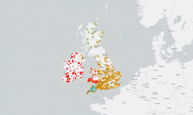
Hero banner
St. Kevin’s College
Building skills for life through creative projects
Transition Year students at St. Kevin’s College on the north side of Dublin have used ArcGIS in an incredibly diverse and creative range of projects, from searching for Hollywood film locations to exploring the viability of ‘no-fry’ zones. The students’ use of professional GIS technology has helped them develop the decision-making, team-working and presentation skills that will be invaluable in their future lives.
Students use ArcGIS to analyse data and make informed decisions
Groups deliver effective presentations using ArcGIS Story Maps
Teacher gains free training, a wide range of resources and ongoing support
Why GIS?
For geography teacher Andrew Horan, ArcGIS for Schools was the perfect solution to an unexpected challenge. He discovered, quite late in the summer, that he would be teaching Transition Year students from September and, as he had not taught Transition Year for four years, his previous teaching materials were outdated. With limited time available, he needed to come up with a new programme that he could put into place quickly and that would engage and inspire his students.
“A colleague mentioned the ArcGIS for Schools programme and it ticked all the right boxes,” Horan says. “I wanted to offer something new and exciting. Straight away, I could see that ArcGIS would encourage a more active learning approach, incorporate ICT into geography and allow students to explore local, national and international issues.”
I can’t speak highly enough of the help I received from Esri Ireland, right from the start.
Benefits for students
During the course of the school year, over forty Transition Year students had the opportunity to use ArcGIS in a geography programme that was based around a series of creative projects. According to Horan, “ArcGIS helped the students develop critical project skills, from how to gather, analyse and reflect on data, to how to work as part of a team and present your results.”
One group considered if it would be possible to establish a new school anywhere in Dublin, without it being within a ten minute walk of a fast food takeaway, and discovered that it was impossible to find a ‘no-fry’ zone. Another group conducted a nationwide search for remote locations that could be used as Hollywood film sets and might prove as successful as the island of Skellig Michael, in Kerry, where filming took place for Star Wars, The Last Jedi. “I was quietly impressed by the range of project titles that students selected and the way that they went about exploring data with ArcGIS to support their ideas.”
ArcGIS was particularly effective in helping the students to develop skills in analysing information and finding evidence to support decision-making. In one block of lessons, the Transition Year students were asked to find the best site to locate a new business, in their choice of industry, in Dublin, in an empty building or on a parcel of land available for development. Using ArcGIS, the students were able to take into account a wide range of factors, including transport links, local skills, the locations of suppliers and the distance to Dublin airport, to inform their decisions about the best sites.
Students were also able to hone their presentation skills, by creating ArcGIS Story Maps to present their projects. One group created a Story Map to share its findings about accident black spots in the local area. “All the project skills our students developed during their Transition Year will be invaluable for them in their future careers, particularly if they go into engineering or town planning roles,” Horan says.
ArcGIS helped the students develop critical project skills, from how to gather, analyse and reflect on data, to how to work as part of a team and present your results.
The teacher’s perspective
Through the ArcGIS for Schools programme, Horan was able to access free training, ready-made lesson plans and hand-outs which helped him prepare for his Transition Year class in a matter of weeks. “I can’t speak highly enough of the help I received from Esri Ireland, right from the start,” Horan says. “Any fears I had about not being prepared for teaching Transition Year were wiped away.”
During the course of the year, experts at Esri Ireland were always on hand if Horan or his students had any queries, and this was very reassuring and helpful. Now, Horan is looking ahead to another academic year and will be using ArcGIS with Transition Year students for the second year running. Esri Ireland has provided a GIS mentor to provide ongoing support to the staff at St. Kevin’s College and is helping Horan to fine tune a 10-week Transition Year programme. Without hesitation, Horan reports, “The ongoing support has been amazing”.
Methodist College Belfast
Hero banner
Methodist College Belfast
Opening the door to university and employment
Pupils at Methodist College Belfast have the opportunity to use ArcGIS in the classroom, in the field and in extra-curricular activities. In these ways, they are gaining the real-world GIS skills that will give them an advantage at university and in their future careers.
In the classroom, pupils engage more enthusiastically in their geology lessons using ArcGIS
During field trips, pupils can collect more accurate data using ArcGIS on smartphones
In extra-curricular activities, groups have achieved success using ArcGIS in competitions
Why GIS?
Affectionately known as Methody, Methodist College Belfast is one of Northern Ireland’s leading grammar schools. Pupils here have the opportunity to study Geology and Geography courses at GCSE, AS and A Level, as well as participate in a wide variety of extra-curricular opportunities that strive to develop pupils’ interest in university courses and careers relating to Geology and Geography.
Geology teacher Karen Parks needed to integrate the use of geographic information system (GIS) technology into her teaching with A Level students, because the compulsory ‘Practical Endorsement’ part of the A Level states that students must be able ‘to compile and analyse geological data sets through to visualisation using GIS’. In addition, she wanted to integrate GIS into more of her lessons with pupils of all ages, to ignite their interest in GIS and give them real-world IT skills that they may need in their future studies and work. She therefore signed up to use Esri’s ArcGIS platform free of charge, through the ArcGIS for Schools programme.
When my students go to university to study geology, geography or other related courses like civil engineering, they are not afraid to use GIS. They already have real-world GIS skills, which puts them a step ahead of other students.
Benefits for students
Parks now regularly uses ArcGIS solutions and interactive maps available in ArcGIS Online, along with teaching resources prepared by Esri Ireland, to make lessons fun and engaging for pupils. For example, she helps pupils understand the potential impact of volcanoes using the ArcGIS Online Volcano Top Trumps map, where volcanoes around the world are given scores for height, deadliness, unpredictability and destruction potential. “I find that the pupils who engage well with GIS tend to get a better understanding of global issues, as they can think about them spatially,” she says.
The Geography teachers at Methody will also be using the Esri’s Survey123 app to allow students to collect data on their smartphones while on field trips. Use of this mobile GIS solution enables pupils to record very accurate locations on maps, take their own pictures and make notes in any weather, without worrying about soggy paper. Pupils have enjoyed using the technology in the field, and Parks expects to use Survey123 during all geology field work at GCSE and A Level in the incoming academic year. She says: “Using GIS in the field gives pupils an insight into the working world. Professionals in a wide range of civil engineering and environmental careers need to be able to access and use maps in the field.”
Pupils have also had the opportunity to use GIS in extra-curricular activities and deepen their knowledge of GIS. For example, a group of students recently used ArcGIS as part of research to enter the National Schools Geology Challenge and also participated in the Association for Geographic Information (AGI) conference in Belfast. They used ArcGIS to explore the environmental, economic and social impacts of renewable and non-renewable energy sources and presented their ideas in a presentation and poster entitled ‘Fuel for Thought’.
“When my students go to university to study geology, geography or other related courses like civil engineering, they are not afraid to use GIS,” Parks says. “They already have real-world GIS skills, which puts them a step ahead of other students.”
I find that the pupils who engage well with GIS tend to get a better understanding of global issues, as they can think about them spatially.
The teacher’s perspective
Before starting to teach ArcGIS in the classroom and on field trips, Parks attended an ArcGIS for Schools training course organised by Esri Ireland and a Geomentor from Esri Ireland came to Methody to deliver training workshops for some Geography and Geology students. She then took advantage of some of the ready-made resources that have been prepared by Esri Ireland for teachers to use, adapting some of them and using others straight ‘out of the pack’, which saved her time.
Parks has had tremendous support from Geomentors at Esri Ireland and Queens University, Belfast, who have encouraged her and given her practical help and tips along the way. She has also benefited from help from the wider GIS community, including the Geological Society Northern Ireland. “Lots of people have been very enthusiastic about ArcGIS and that has made all the difference,” she says.