Hero banner
St Conleth’s Community College
Developing students’ critical thinking abilities
Students of all abilities at Saint Conleth’s Community College are developing important life skills through the use of ArcGIS. Whether they are undertaking field-work surveys in the Burren or analysing information in the classroom, they are engaging enthusiastically in their geography lessons and developing critical thinking abilities.
Students develop valuable life skills in areas such as critical thinking
Young people of all abilities can learn and succeed in geography lessons
ArcGIS supports independent and collaborative learning in classrooms and during field trips
Why GIS?
At Saint Conleth’s Community College in Newbridge, County Kildare, Ireland, teachers proactively seek out new ways to expand the learning opportunities for their students, recognising that practical skills are as valuable as academic skills.
Deirdre O’Crowley, a geography teacher at the school wanted to embed the use of geographic information system (GIS) technology into her lessons to help her broaden the learning experiences for students. “Geography is not just about theory,” she says. “There are lots of practical elements to the teaching of geography. I felt that GIS would complement and enhance the other skills that students develop throughout the Junior and Senior Cycles.”
As a result of O’Crowley’s enthusiasm for GIS, Saint Conleth’s Community College became one of the first schools in Ireland to participate in Esri Ireland’s ArcGIS for Schools Program. Through this scheme, the school now has free access to Esri’s digital mapping platform, ArcGIS Online, along with lesson plans, teaching resources and guidance from GIS professionals.
ArcGIS enhances students’ engagement in learning about geography and helps them to become critical thinkers.
Benefits for students
Having now used ArcGIS with students for a full academic year, O’Crowley is convinced that the technology delivers significant benefits for students. She says, “ArcGIS enhances students’ engagement in learning about geography and helps them to become critical thinkers. Using ArcGIS they can query multiple layers of data on interactive maps, explore environments and constantly ask questions to find answers.”
O’Crowley also recognises that ArcGIS enhances learning for students will all levels of ability. “ArcGIS promotes an inclusive learning environment,” she says. “Using ArcGIS in the classroom gives students of all abilities the opportunity to excel in geography. It helps them to work collaboratively and develops their vocabulary which benefits other subjects.”
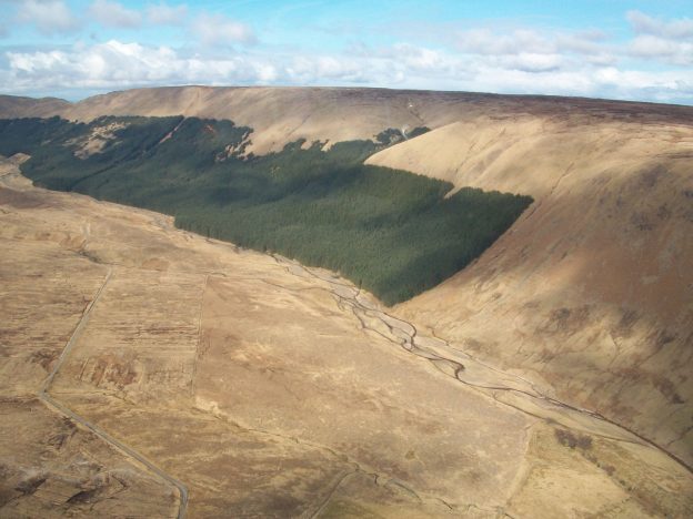
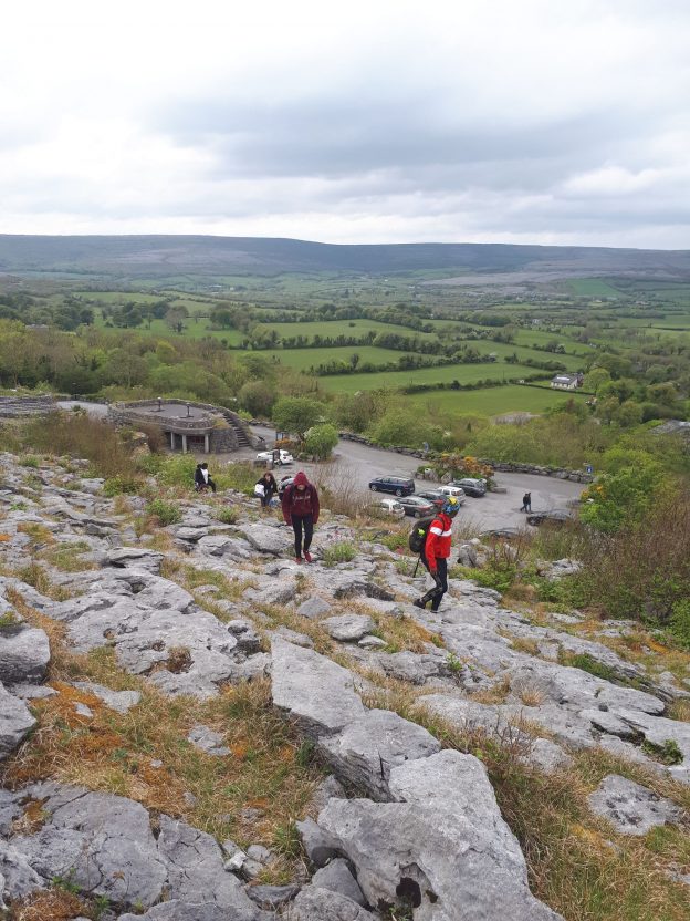
O’Crowley has employed ArcGIS very effectively with a group of fifth year students as part of a field trip to the Burren, or ‘Rocky Place’ in Co. Clare. This limestone landscape features unusual stone patterns and is often visited by school groups as part of their geography studies. The students from Saint Conleth’s Community College used ArcGIS to plan their research and created a Story Map to plot their route to the research location. Once in the field, they used an ArcGIS mobile app, Survey123 for ArcGIS, to collect data on their mobile phones about underground features such as stalactites and surface features such as limestone pavements. Then, afterwards, the students used ArcGIS Online to visualise their survey results on a field study map layer, analyse their results and present their findings.
In addition, Saint Conleth’s Community College has used ArcGIS in the classroom to support teaching on topics as diverse as earthquakes and economic development. In one project, pupils were shown how to use ArcGIS to help them identify the best location to set up a multinational company, taking into account factors such as local employment, transport services, training providers and communications. “Students have been very creative and motivated in their use of ArcGIS,” says O’Crowley. “I have been able to give them a brief outline of the task to complete, which allows them to become independent learners.”
A number of students have used ArcGIS Online independently to create Story Maps combining pictures, videos, maps and data to help them revise for exams. “Students like the interactive and creative way of learning,” O’Crowley says.
Using ArcGIS in the classroom gives students of all abilities the opportunity to excel in geography.
The teacher’s perspective
To build up her own GIS skills, O’Crowley has attended free training sessions and workshops held by Esri Ireland. She has also taken advantage of Esri Ireland’s pre-prepared teaching materials to help her incorporate ArcGIS Online into her lesson plans.
Such is her continuing enthusiasm for the ArcGIS for Schools Program that O’Crowley is now actively promoting it to other teachers, both within her own school and at other schools. She hopes to encourage her teaching colleagues at Saint Conleth’s Community College to use ArcGIS with first year geography students for the first time and even embed ArcGIS into science lessons. “The more I use ArcGIS in teaching, the easier it gets,” she says. “I urge other teachers to give ArcGIS a go, make a plan and use it regularly.”